
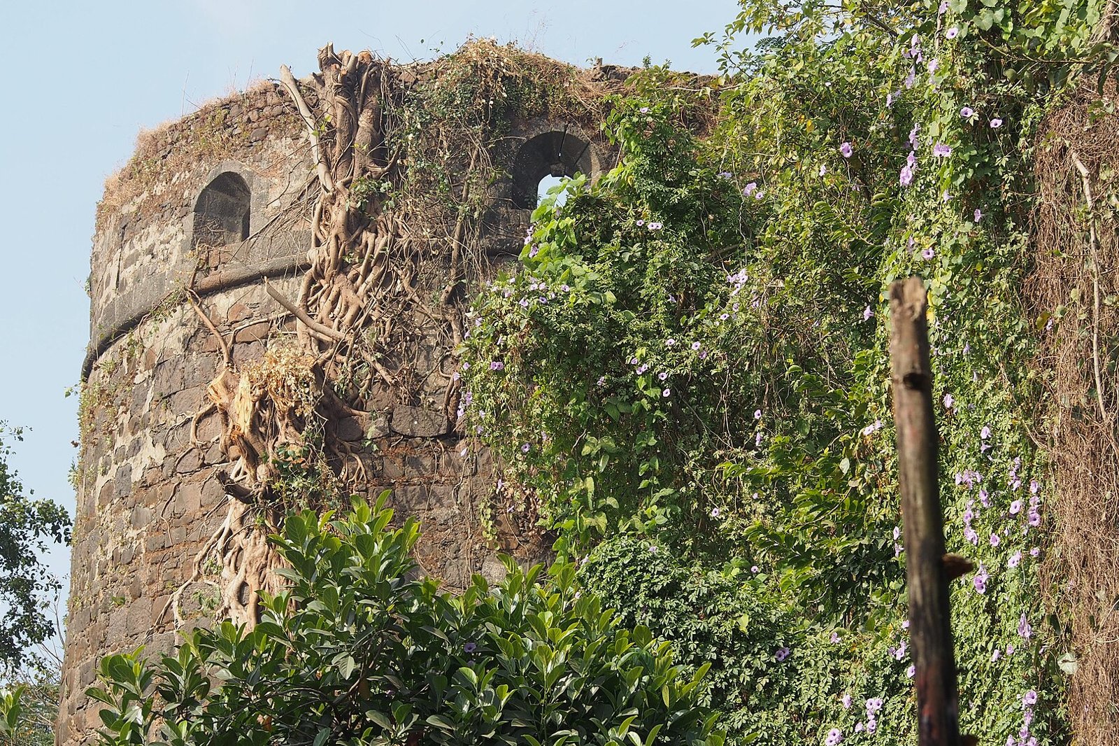
Photo: Pradeep717, Wikimedia Commons, CC BY-SA 4.0. Belapur Fort in CBD Belapur, a heritage landmark and not a typical village street.
Quick answer: A gaothan is the settlement area of a village, and in planning documents it has a legal meaning: the area shown as gaothan on the revenue village map, including the village site fixed under Section 122 of the Maharashtra Land Revenue Code (CIDCO, NAINA development control rules). Navi Mumbai was planned around villages that already existed, so the old settlements sit inside the planned nodes. This guide explains the terms, the planning history, and how a gaothan differs from a Koliwada. It does not give a village count, because the number depends on which boundary you use.
This is an independent overview based on published planning documents and reports. It is not legal or property advice, and it is not affiliated with CIDCO or any civic body.
What is a gaothan?
In everyday speech, people use gaothan, gaon and “the old village” for the original settlement that was there before the planned city. In planning and revenue records the word is narrower. The sanctioned development control rules for the Navi Mumbai Airport Influence Notified Area (NAINA) define gaothan as the settlement area shown as gaothan in the revenue village map, including the land within the village site set under Section 122 of the Maharashtra Land Revenue Code, as shown on the development plan (NAINA development control rules).
- Everyday meaning: the old part of a village, often recognisable by narrow lanes, temples and clustered houses.
- Legal meaning: a mapped boundary in the revenue and planning records. A building that looks old but sits outside that line is not automatically in the gaothan.
- Where the rules apply: the definition above comes from the NAINA rules. Areas under the Navi Mumbai Municipal Corporation (NMMC) or Panvel Municipal Corporation have their own development plans, so check the plan that covers your parcel.
Villages and the planned city
CIDCO’s own draft development plan document gives the outline. CIDCO was incorporated as a limited company on 17 March 1970 and was appointed the New Town Development Authority on 20 March 1971. Its development plan for Navi Mumbai covered 95 villages from Thane and Raigad districts, over 344 sq km (CIDCO draft development plan document).
Other sources use other numbers. Wikipedia, for example, says the government notified land in 86 villages for acquisition by February 1970, and nine more were added in 1973 (Wikipedia, CIDCO). Both figures describe real boundaries at different points, which is why this guide gives no single total. If you see a village count, check whether it refers to the 1970 acquisition, the development plan, the NMMC area or the wider NAINA region.
The same CIDCO document notes that in the project area of the planning authority, no revenue gaothan settlement was observed in sixteen of the villages it examined. So the villages are not all alike on the map either.
Wikipedia also notes that the city’s growth gathered pace after 1990, with the Turbhe wholesale market and the Mankhurd to Vashi railway link in 1992, and that gaothans and urban villages have seen buildings that break planning norms (Wikipedia, Navi Mumbai). Treat that as background, not as a finding about any one village.
Gaothan versus Koliwada
The two words are not interchangeable. Gaothan describes a village settlement area in the revenue and planning sense. A Koliwada is a hamlet of the Koli fishing community. A 2025 Regional Studies Association blog describes Koliwadas as self-contained maritime settlements with their own cultural, linguistic and economic rhythms, and says the Kolis have lived along this coast since at least the 15th century (Regional Studies Association).
| Gaothan | Koliwada | |
|---|---|---|
| What the word describes | A village settlement area, mapped in revenue and planning records | A hamlet of the Koli fishing community |
| Where you find it | Villages of any community, inland or coastal | Coastal and creekside settlements |
| Legal weight | Has a defined meaning in planning rules | Mainly a community and cultural term |
A coastal village can be both: the Koli community’s hamlet may also be the mapped gaothan. Do not assume that every gaothan is a Koliwada, or the reverse.
Selected villages
The published record is richer for some villages than others, so this list is short on purpose. It covers places where the location and the source are clear.
| Village | What is documented | Nearest station or link |
|---|---|---|
| Belapur (CBD Belapur) | Belapur Fort, looked after by CIDCO, is the main heritage site in the area. See our Belapur Fort guide for who built it and what the access status is, and our CBD Belapur area guide for the wider node. | Belapur CBD, Harbour line |
| Diwale | A 2021 field study by urbz describes a fishing village with a fish market, a jetty where boats are repaired, temples used as public spaces, and festivals such as Narali Poornima (urbz). The study does not give directions, so confirm the location on a map before you plan a visit. | Check on a map |
| Turbhe | Part of the NMMC area, and known for the Mumbai APMC wholesale market (Wikipedia, Turbhe). A village history was not found in the sources used. | Turbhe, on the Thane to Vashi and Panvel line |
| Ghansoli | One of the NMMC nodes (Wikipedia, Navi Mumbai). A village history was not found in the sources used. | Ghansoli, between Rabale and Koparkhairane (Wikipedia) |
Individual village profiles will follow when there is enough documented history to write a useful one.
Visiting responsibly
- Gaothans and Koliwadas are people’s homes and workplaces. Keep to public lanes and do not enter courtyards, boat yards or fish drying areas unless invited.
- Ask before you photograph people, their homes or their catch. Skip photos of children.
- Temples and community spaces may have their own rules. Follow the signs and any instructions from residents.
- Fish markets and jetties are working places. Stay out of the way during landing and loading hours.
- Keep noise down, carry your litter out, and do not fly drones over residential areas.
- Belapur Fort is not set up for visitors. Do not enter barricaded areas or climb the walls.
Property questions
Land status in and around a gaothan varies from one parcel to the next, so this guide does not say what you can buy, build or redevelop. Whether a plot is inside the mapped gaothan, in an extension area, or on land CIDCO acquired changes the rules and the documents you need. For related checks, see our NAINA land buying checks and our Maha BhuNaksha guide, and confirm the status of any specific parcel with CIDCO, the local civic body or a qualified lawyer before you pay anything.
Frequently Asked Questions
What is a gaothan?
It is the settlement area of a village. In planning rules it means the area shown as gaothan on the revenue village map, including the village site fixed under Section 122 of the Maharashtra Land Revenue Code.
How many villages are in Navi Mumbai?
There is no single answer. CIDCO’s development plan covered 95 villages, while other sources cite 86 for the 1970 acquisition. The count depends on the boundary used.
Is a Koliwada the same as a gaothan?
No. A Koliwada is a hamlet of the Koli fishing community, while gaothan is a mapped village settlement area. A coastal village can be both.
Can I visit the villages?
The lanes are public, but they are also homes and workplaces. Be discreet, ask before photographing anyone and avoid working areas.
Can I buy property in a gaothan?
It depends on the parcel. Check its status with CIDCO or the local civic body and take legal advice before paying.
Sources
| Point | Source |
|---|---|
| Gaothan definition, Section 122 | CIDCO, sanctioned NAINA development control rules |
| CIDCO dates, 95 villages, 344 sq km | CIDCO, draft development plan document |
| 86 villages, 1970 and 1973 notifications | Wikipedia, CIDCO |
| Koliwada description | Regional Studies Association blog, 2025 |
| Diwale | urbz, Spatial synergies in urban villages, 2021 |
| Turbhe, Ghansoli, city growth | Wikipedia, Turbhe, Ghansoli station and Navi Mumbai |
Checked 12 November 2026. Confirm planning and land details with the relevant authority.
NaviMumbai.com is an independent information site and is not affiliated with any government body.