Malshej Ghat is a hill pass in Thane district on the Kalyan to Nagar road, known for mist, waterfalls and green slopes in the rains. This guide helps you plan a Malshej trip from Navi Mumbai: how far it is from named starting points, how to get there by train and bus, where to stop, what a one day or overnight plan can look like, and what to check before you go. Waterfall viewing and trekking are separate from the drive and are planned separately.
Access check before you travel: road access and permission to visit waterfalls or trails are separate matters. Restrictions and road damage were reported during the 2026 monsoon, and current conditions have not been independently confirmed. Check with the highway police and the relevant local administration before you leave. The reported road damage was near Karanjale in Junnar taluka, not only in Thane district. Historical reports are summarised lower down.
This guide is independent and is not run by any authority.
Malshej Ghat distance and road route from Navi Mumbai
The Thane district tourism page lists the route from Mumbai as Thane, Kalyan, Murbad, Shivale, Saralgaon, Kasgaon, Tokawade and Malshej Ghat, and puts it about 126 km from Mumbai. That figure is from Mumbai and not from Navi Mumbai. The table gives one way road distances from Navi Mumbai starting points to a map point at the MTDC resort on the ghat.
| Starting point | Approximate one way road distance to the MTDC resort landmark |
|---|---|
| Airoli (Airoli railway station area) | About 114 km (route) |
| Vashi railway station | About 119 km (route) |
| Panvel railway station | About 123 km (route) |
Method: OSRM routing on OpenStreetMap data, checked on 24 October 2026. These are distances and not travel times. Sightseeing stops add distance, and traffic and the weather change the journey, so no travel time is given here. A route that appears on a map does not show that the road is open, so check the access notice above. The Navi Mumbai toll plazas guide covers Navi Mumbai tolls only and not every toll on this route.
Public transport from Navi Mumbai
The Thane page lists Kalyan as the nearest railway station. Plan the journey in these steps:
- Reach Kalyan from your Navi Mumbai starting area. See the Mumbai local train guide for the lines.
- Find where the onward bus boards at Kalyan, and confirm that the service passes the Malshej stop you want.
- After you get off, check how you reach your stay or the sightseeing area.
- Confirm the return departure time and boarding location before leaving Kalyan. An onward service does not guarantee a convenient return.
Outlook Traveller advises a state bus or a taxi from Kalyan. No specific bus service, timetable or stop is given here, and no fares are quoted.
Best season for your trip
| Your priority | Guidance |
|---|---|
| Waterfalls and green scenery | The monsoon, subject to the weather and access restrictions. The Thane page describes mist and a peak in visitors in the rainy season. |
| Sightseeing with less emphasis on waterfalls | Consider the post monsoon and winter months. Maharashtra Tourism describes cooler season sightseeing and outdoor activities across the state (Maharashtra Tourism). |
| Trekking | Choose according to the specific route and the current conditions. |
| Birdwatching | Check recent local sightings. No species is guaranteed. |
No season is automatically safe. Waterfall flow and visibility depend on recent weather.
Places to visit
| Stop | What to expect | Notes |
|---|---|---|
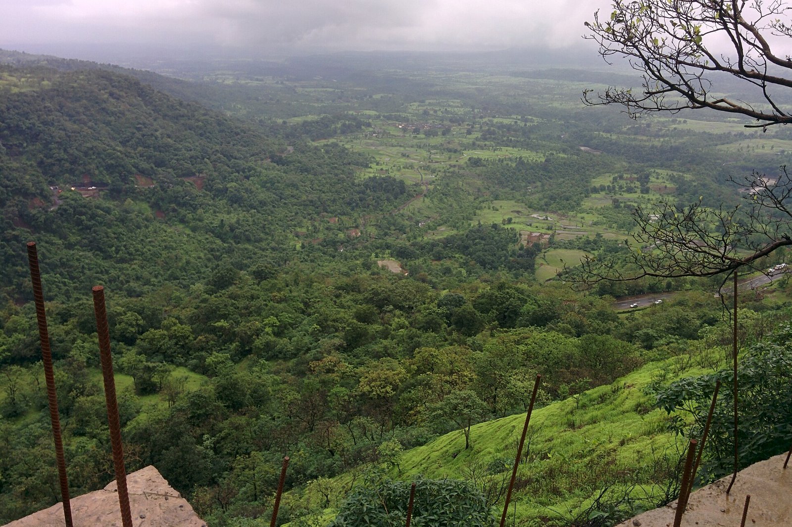
| Roadside viewpoints on the ghat | Views over the valley, with mist in the rains. | Pull over only where it is safe, and expect crowding at weekends. |
| Waterfalls along the road | Flow depends on recent rain. | Access may be restricted in the monsoon. Do not stand in or near flowing water. |
| Pimpalgaon Joga dam area | Maharashtra Tourism associates flamingo watching with this area. Outlook Traveller describes it as good for birdwatching. | Sightings are not guaranteed, and the dam structure is not open to unrestricted access. |
| MTDC resort area | A landmark and a possible base, used here as the distance destination. | Check booking and access with MTDC. |
Flamingos are reported from July to September by Outlook Traveller. They are linked to a particular waterbody and not to the whole ghat, and a visit does not promise a sighting. Parking and exact stopping points are not confirmed here, so check them locally.
One day and overnight plans
These are editorial plans, conditional on access and the weather. Avoid fixed clock times until you have checked travel durations.
| Stage | Sightseeing day trip | Overnight sightseeing trip |
|---|---|---|
| Departure | Leave early with breakfast planned. | Travel with time for a meal and check in. |
| Main visit | A small selection of viewpoints. | Viewpoints and relaxed local sightseeing. |
| Additional stop | Optional, depending on conditions. | A separately planned dam area or birdwatching visit. |
| Return | Allow time to descend before dark. | Return after the next morning’s visit. |
Keep trekking separate. An overnight stay does not make Harishchandragad a straightforward add on.
Stay, food and trip costs
- Stay: MTDC has a resort at Malshej Ghat. Check booking, rates and availability on the MTDC website, since none is quoted here. Private stays vary, so confirm the location and check in time.
- Food and toilets: plan meals and breaks in advance, and carry water.
- Parking: confirm where to park before you arrive.
- Connectivity: mobile coverage can be patchy on the ghat, so download an offline map.
- Return preparation: fill fuel before the ghat and plan the return journey.
Budget by listing quotes for fuel or transport, tolls, meals, parking, accommodation and any separately booked trek. No per person total is given.
Treks are separate trips
The roadside stops do not need a trek. The treks around Malshej have different routes and starting villages, so plan each with a local guide:
- Waterfall treks: Outlook Traveller mentions Kalu waterfall and the falls near Old Malshej Ghat. The starting village, the route, whether the distance is one way or return, and any stream crossings are not confirmed here. Operator guidance warns about water crossings, unstable ground and route changes when conditions worsen.
- Harishchandragad: Outlook Traveller mentions the Kedareshwar cave and advises a guide.
Difficulty depends on the route, the weather and your fitness. For other trips, see the winter treks guide, and compare an overnight nature break with the Bhandardara guide or browse the weekend getaways guide if you are still choosing a destination.
Historical access reports from 2026
| Date reported | Report |
|---|---|
| 23 to 24 June 2026 | A landslide between the wash point and the umbrella point at Malshej Ghat was cleared quickly, with no casualties and no closure reported, according to Telangana Today. |
| Early July 2026 | A report on ThePrint describes a Thane district order banning entry to forts, waterfalls and water bodies because of heavy rain forecasts. It does not name Malshej Ghat, and it does not by itself mean the through road was closed. |
| 26 to 27 July 2026 | Reports say the Malshej Ghat section of NH 61 was shut until further orders after the road subsided near Karanjale in Junnar taluka (Punekar News and The Bridge Chronicle). Traffic was diverted by other routes. No later report on reopening was found. |
These reports do not show whether the road or any attraction is open today. Do not assume the destination is closed or open from them, and check current notices.
Frequently Asked Questions
How far is Malshej Ghat from Navi Mumbai?
By road, about 114 km from Airoli, 119 km from Vashi railway station and 123 km from Panvel railway station, one way, to a map point at the MTDC resort. These are distances and not travel times.
Is Malshej Ghat open now?
Road access and permission to visit waterfalls or trails are separate matters, and conditions have not been independently confirmed. Restrictions and road damage were reported in the 2026 monsoon, so check with the highway police and the local administration.
How do I reach Malshej Ghat by public transport?
Reach Kalyan, the nearest station, then take an onward bus or taxi. Confirm the bus stop, that the service passes your Malshej stop, and the return departure before you leave Kalyan.
When is the best time to visit Malshej Ghat?
It depends on what you want. The monsoon suits waterfalls and green scenery, subject to weather and restrictions, while post monsoon and winter suit sightseeing with less emphasis on waterfalls.
Can I do Malshej Ghat in a day from Navi Mumbai?
It is possible, depending on access and the weather. Plan an early start and a return before dark, and keep trekking as a separate trip.
Are flamingos seen at Malshej Ghat?
Maharashtra Tourism associates flamingo watching with the Pimpalgaon Joga area. Sightings are not guaranteed, so check recent local reports.
Sources and a note on accuracy
| Claim | Source |
|---|---|
| Route from Mumbai and nearest station | Thane district tourism page |
| Season, flamingos and treks (reported) | Outlook Traveller and Maharashtra Tourism |
| June landslide | Telangana Today |
| July Thane district order | ThePrint |
| July road subsidence | Punekar News and The Bridge Chronicle |
| Road distances | OSRM routing on OpenStreetMap data, checked 24 October 2026 |
Reviewed on 24 October 2026. Current road status, entry arrangements, MTDC booking details and viewpoint locations were not confirmed.
Featured photo: Aerial view, Western Ghats, Malshej Ghat by akshaybapat4, licensed CC BY-SA 4.0 via Wikimedia Commons, cropped and resized.
NaviMumbai.com is an independent information site and is not affiliated with MTDC or any authority.