Cooler weather can make winter a useful season for planning treks from Navi Mumbai, but the route, current conditions and your group’s experience still determine suitability. This guide compares five destinations and the access, transport and preparation checks to complete before travelling.
Quick answer: Maharashtra Tourism’s adventure leaflet describes October to February as the prime period for adventure activities such as trekking and camping, and its destination pages give October to March for Lohagad, Rajmachi and Harishchandragad and October to May for Kalsubai. That is seasonal planning guidance. It does not say that a route is open on your date, so check access, the weather and conditions for the route you choose. Karnala is in Raigad district near Panvel. Lohagad and Rajmachi are in Pune district, and Harishchandragad and Kalsubai are in Ahilyanagar district (formerly Ahmednagar), so those four need a longer journey.
What changes in winter
- Dry weather reduces some rain related hazards, not all risks. It does not remove the chance of sudden rain, slippery rock or loose stone, so check the weather and any closure notice for your date.
- Do not assume seasonal water sources will be available or safe. Streams and waterfalls that run in the monsoon can be dry or unsuitable to drink from, so plan to carry the water you need.
- Daylight is shorter. The sun goes down earlier than in summer, so fix a turnaround time before you start and keep to it, even if the top looks close.
- Check the forecast for your destination, not only Mumbai. The India Meteorological Department Mumbai page is a starting point, but Raigad, Pune and Ahilyanagar districts can differ. Use the IMD site for the district forecast and any warnings, including overnight conditions if you will stay out.
- Mornings can be cold and hazy, and a dry trail can still be slippery. Wear shoes with grip, not sandals. If you have a breathing condition, check the day’s air quality too, using our air quality guide.
Where to trek from Navi Mumbai
Maharashtra Tourism lists Rajmachi Fort, Harishchandragad Fort, Kalsubai Peak and Lohagad Fort among the state’s trekking trails in its adventure leaflet, and covers them further on its adventure tourism page. Karnala is covered in its wildlife leaflet. The table sets out what changes your plan for each one. It is a planning aid, not a confirmation that any route is open.
| Destination (district) | Main activity | Route choice that changes the plan | Transport and overnight decision | Access source to check |
|---|---|---|---|---|
| Karnala (Raigad) | Birdwatching visit or fort trek | Sanctuary nature trails or the fort trail. Decide before you go | The wildlife leaflet gives Panvel as the access point, 12 km by rail and 13 km by road. Plan the last stretch and a return in daylight | The sanctuary entry office, and our Karnala Bird Sanctuary guide |
| Lohagad (Pune) | Fort trek | The Malavli approach on foot, or the motorable road from Lohagadwadi to the fort’s base | Malavli is the nearest station. Plan the return transport before you start | Notices from the police, district administration or forest authority for your route |
| Rajmachi (Pune) | Trek to two forts, Shrivardhan and Manaranjan | Which approach you take, where you start walking, and which fort or forts you visit | The tourism page calls it an ideal overnight trek with camping options. Decide whether you need to stay, and book it | Notices for your route, and the rules of the place you stay |
| Harishchandragad (Ahilyanagar) | Fort trek | Pachnai, Khireshwar or Nalichi Vaat, which differ greatly in difficulty | Kalyan and Igatpuri are the nearest stations on the tourism page. Choose a day trip or overnight stay from your route, pace and daylight | The Forest Department office for the Kalsubai Harishchandragad Wildlife Sanctuary |
| Kalsubai (Ahilyanagar) | Peak climb | Start from Bari village. The route has ladders and rocky patches | Igatpuri is the nearest station, about 45 km away on the tourism page. Decide your start time from the daylight | The Forest Department office, and notices for your route |
How far each one is from your door depends on where in Navi Mumbai you start, and whether you go by train, bus or car. Check the route on a live map for your own journey, and use the planning worksheet below to record it.
Karnala: choose between a birdwatching visit and the fort trek
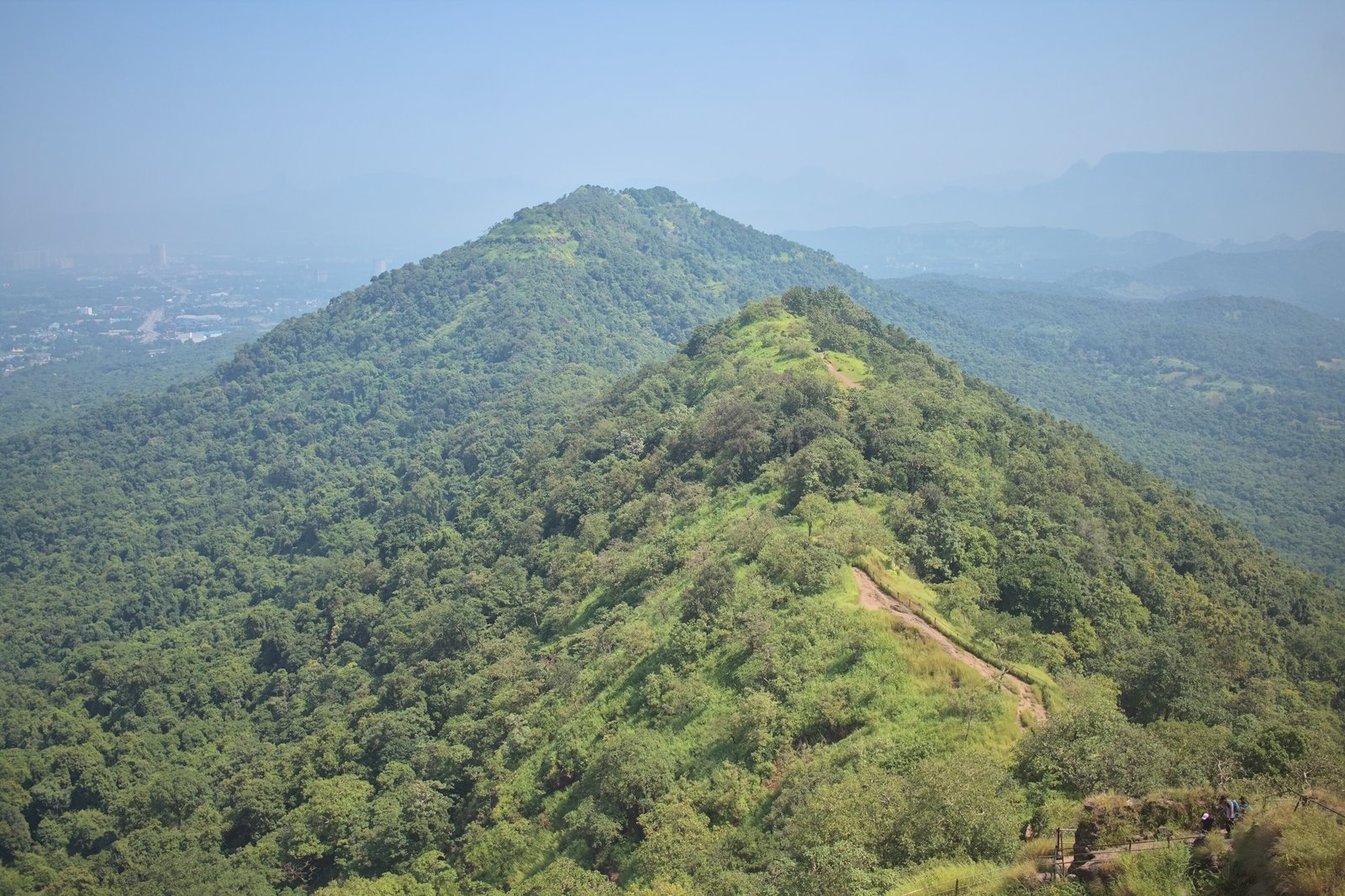
Karnala is a bird sanctuary with a fort in its centre, so decide first which outing you want. The wildlife leaflet quotes 147 species of resident birds and 37 species of migratory birds that arrive in winter, and also mentions butterflies. Those are the leaflet’s figures, not a current count, so treat them as a guide to what the sanctuary is known for. The leaflet gives June to December as the best time to visit.
Allow separately for travel, sanctuary entry, your chosen walk or climb, and the return journey. Do not assume a fort trek will fit a half day window. The Panvel distances above are access figures from the leaflet, not a measured journey from your address, and they do not tell you the walking distance or the time the trail takes. Confirm the entry hours, the open trail and the last entry time with the sanctuary, and see our Karnala Bird Sanctuary guide for the trails. Reach Panvel by local train, as the Panvel railway station guide and the local train guide explain.
Lohagad
Maharashtra Tourism’s Lohagad page describes the most popular trail as starting at Malavli and passing the Bhaja Caves, with a motorable road from Lohagadwadi village to the fort’s base as an easier approach. It names Malavli as the nearest railway station and says autos and taxis run from Lonavala to Malavli or Bhaje village. The figures for the distance from Malavli vary between the tourism pages, so confirm the walking distance with your operator or someone local before you plan your timing.
Choose your approach and your return transport before you go. The tourism page highlights the Vinchukata section of the fort, so ask about the conditions there. It also recommends early morning or late afternoon visits for the light and to avoid the crowds, and gives October to March as the pleasant season.
Rajmachi
Rajmachi has two forts, Shrivardhan and Manaranjan. The adventure tourism page calls it an ideal overnight trek with camping options, gives October to March for pleasant weather, and says the trail is scenic. Before you commit, decide which approach you will use, where you will start walking, which fort or forts you will visit, and whether an overnight stay is actually needed. That depends on your starting point, your pace and the daylight, not only on the destination. Our monsoon treks guide explains how to establish the approach and the return transport, and the same questions apply in winter.
Harishchandragad
Harishchandragad is not one uniform trek. The tourism page describes three routes of very different difficulty, and your choice changes the plan more than anything else.
| Route | What the tourism page says | What it changes |
|---|---|---|
| Pachnai | Called the easiest route, about 3 km one way and 2 to 3 hours, with gentle slopes | The simplest option on the page, though you still need to confirm access and plan your return |
| Khireshwar | Called the most popular and scenic route, moderate to difficult and best suited to experienced trekkers, about 7 km one way and 6 to 7 hours. Starts at Khireshwar village near Malshej Ghat and passes Tolar Khind | A long day, so daylight and turnaround time matter, and an overnight stay is a real option |
| Nalichi Vaat | Called extreme, about 8 km one way and 8 to 10 hours, with rock climbing, vertical ascents and technical sections that need ropes. For seasoned trekkers with climbing experience | A technical climb that needs the right experience, equipment and leader. The page also notes the dangers of rockfall and strong winds |
These are general descriptions from the tourism page, not guarantees. Your pace, your group and the conditions will change the timings, so ask your operator before you set a turnaround time. The page also describes October to March as a good time, and mentions crisp nights that suit camping. Harishchandragad lies in the Kalsubai Harishchandragad Wildlife Sanctuary, so check entry arrangements with the Forest Department, as the permit answer below explains.
Kalsubai
Kalsubai is the highest peak in Maharashtra at 1,646 metres, in Ahilyanagar district. The tourism page names Bari as the base village and the starting point, reachable by private vehicle or state transport bus, with Igatpuri about 45 km away as the nearest railway station. It describes the trek as moderately challenging, with ladders and rocky patches, and the adventure tourism page gives October to May as the best time.
If you plan to reach the summit for sunrise, part of the climb will be in the dark. That needs a headlamp with spare power, a leader who knows the route, and a plan for the descent. The tourism page also suggests hiring a local guide for the terrain and for safety, and asks trekkers to carry their waste back.
Camping
The adventure leaflet names Bhandardara, beside Arthur Lake, and Pawana Lake as camping locations. A listing for a destination is not permission to camp at every spot nearby. Before you book, check:
- Whether you have permission to use the specific campsite, and whether overnight camping is allowed there
- What is included, and the cancellation terms, in writing
- Where the drinking water and toilets are, and how emergency access works
- The rules on fires, music and waste
Easier outings close to home
Pandavkada Falls in Kharghar is not included here as a winter outing. Public access to the falls has been restricted in recent years, and what applies now depends on the authorities. Our Pandavkada guide explains the access questions. For an easier day, see the parks and gardens guide, the Central Park Kharghar guide and the free and low cost outings guide, and check each place’s own opening arrangements. The best time to visit Navi Mumbai explains what the seasons are like in the city. For the season’s other plans, see our winter planning guide.
If you are thinking of Matheran, the weekend getaways guide covers it. If you plan to use the toy train, check Central Railway’s current notice for the Neral to Aman Lodge section for your date.
Planning worksheet
Fill this in for each trek before you commit, using real information from your operator or the place you are going. Leave a row blank until you have it.
| What to record | Your notes |
|---|---|
| Starting address in Navi Mumbai | |
| Selected route and trailhead | |
| Outward and return transport | |
| Walking plan: ascent, descent and breaks | |
| Start time and turnaround time, against the daylight | |
| Access: the authority or source, and the date you checked | |
| Water: quantity, reserve and a confirmed safe refill | |
| Overnight stay: permission, booking and cancellation terms | |
| Emergency plan: the leader, contacts and who has your itinerary |
What to pack
- A water plan for your route, with a reserve, and only count on a refill that has been confirmed safe
- A headlamp or torch with spare batteries or power
- An offline map or route file, and a way to identify your trail, since a phone may have no signal
- A light layer for the early start, and weather protection suited to the forecast
- Shoes with proper grip, and a small first aid kit
- Food that does not spoil, and a bag to carry all your rubbish back down
- A charged phone and a power bank, though a charged phone does not guarantee a signal or a rescue
- A copy of your booking, and the phone number of the trek leader or the site
If something goes wrong
Before you leave, tell someone at home your route and the time you expect to be back, and share your live location if you can. If someone is injured or the group is lost, stop and assess any immediate hazards. Contact 112 and the trek leader when you can, giving your route, your last known location and coordinates if you know them. 112 is India’s integrated emergency number, described on the Ministry of Home Affairs page. Follow the instructions of the responders, and do not attempt a hazardous descent just to keep to the itinerary. The Maharashtra State Disaster Management Authority has a page of dos and don’ts worth reading before any hill trip.
Frequently Asked Questions
When is the best time for trekking near Mumbai?
Maharashtra Tourism’s adventure leaflet describes October to February as the prime period for adventure activities such as trekking and camping in the state. That is seasonal planning guidance. Whether a particular route is open on your date depends on the weather and on access notices for that route.
How do I choose between these treks?
Start with your experience, your group and your transport. Karnala suits a birdwatching visit or a fort trek near Panvel. Lohagad and Rajmachi are in Pune district, and Harishchandragad and Kalsubai are in Ahilyanagar district, so they take a longer journey. For Harishchandragad, the route you pick changes the difficulty more than the destination does.
Can I see migratory birds at Karnala in winter?
The Maharashtra Tourism wildlife leaflet says 37 species of migratory birds arrive at Karnala in winter, in addition to 147 resident species. These are the leaflet’s figures, and which birds you see on the day will vary.
Do I need a permit for Harishchandragad or Kalsubai?
Confirm the current entry conditions for your chosen route with the responsible Forest Department office. Ask separately about trekking access, overnight camping and any photography or filming permission that applies to your activity. Requirements can differ by route and activity, and an operator can help you, but its listing is not the permission itself.
Should I do these as a day trip or stay overnight?
It depends on your starting address, your chosen route, your transport, your pace and the daylight, not on the destination alone. A long route or a late finish may need an overnight stay, and a stay needs its own permission and booking. Work through the planning worksheet before you decide.
What should I do if I get lost or injured on a trek?
Stop and assess any immediate hazards. Contact 112 and the trek leader when you can, giving your route, last known location and coordinates if you know them, and follow the responders’ instructions. Do not attempt a hazardous descent just to keep to the itinerary.
Is winter trekking safer than monsoon trekking?
Not automatically. Dry weather can reduce some rain related hazards, but it does not remove sudden rain, slippery rock or loose stone, and winter brings its own risks such as short daylight and no reliable water. Check the weather and access notices for your route, and plan your turnaround time.
Sources and a note on accuracy
Sources checked on 15 October 2026. Season, trek list and camping locations: Maharashtra Tourism’s adventure activities leaflet and adventure tourism page. Karnala bird figures, best time and access: its wildlife leaflet. Routes and access: the Maharashtra Tourism pages for Lohagad, Harishchandragad and Kalsubai. Forest entry arrangements: the Maharashtra Forest Department. Weather: the India Meteorological Department. Emergency number: the Ministry of Home Affairs. Safety guidance: the Maharashtra State Disaster Management Authority. Featured photo: View from Karnala Fort by Shishirdasika, licensed CC BY-SA 4.0 via Wikimedia Commons, resized. This guide is not a live opening notice. Trails, entry rules and train timetables change, so confirm with the site, the forest office or the railway before you travel. NaviMumbai.com is an independent information site and is not affiliated with Maharashtra Tourism, Central Railway or any trek operator.