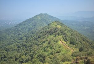
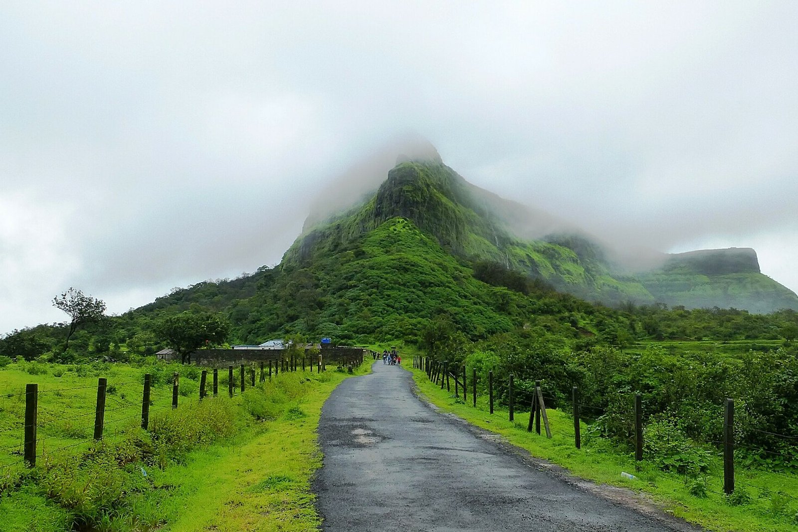
Visapur is a hill fort near Malavli in Maval taluka, Pune district, at 1,084 m (3,556 ft) above sea level, according to Wikipedia. It is a neighbouring fort to Lohagad, and the two are often compared. This guide helps you reach Malavli from Navi Mumbai, choose a starting point, decide between Visapur and Lohagad, and plan a full day with the right season and safety checks.
Access status: current Visapur access has not been independently confirmed. Check local authority notices, weather conditions and trail access before travelling. Historical restrictions are summarised at the end of this guide.
Trail conditions and arrangements change, and many details are not published by the authorities. This guide is independent and is not run by any authority.
How to reach Visapur Fort from Navi Mumbai
Wikipedia names Malavli as the nearest railhead, with local trains to Mumbai, Lonavala and Pune. There is no direct Mumbai suburban local to Malavli, so reach Lonavala using a service that stops there, then use a Pune bound suburban service that stops at Malavli. Check both journeys and your return connection for your travel date on the Indian Railways enquiry. See the Mumbai local train guide for the Navi Mumbai lines and the Navi Mumbai to Lonavala guide for the road.
- Stage 1: Navi Mumbai to Lonavala by a train that stops there.
- Stage 2: Lonavala to Malavli on a Pune bound local.
- Stage 3: Malavli to your chosen starting point by shared vehicle, auto or on foot. Confirm the vehicle, the drop point and the fare locally, since published fares are dated.
By road
These distances run from each starting point to Malavli railway station, using the OSRM routing service on OpenStreetMap data checked on 24 October 2026. The routes use NH 48 and the Mumbai Pune Expressway, which two wheelers may not be allowed to use, so check your own route. They are distances and not travel times. A trailhead or a parking point is a separate destination, so confirm it locally before you drive.
| Starting point | Road distance to Malavli station |
|---|---|
| Airoli | About 86 km (route) |
| Vashi railway station | About 78 km (route) |
| Panvel railway station | About 60 km (route) |
Visapur trek routes and starting points
Trek guides name Bhaje village and Patan village as the usual starting points, and a shorter approach exists from Lohagadwadi. This is why published ascent times differ, since they start from different places. Use the table to compare what each route offers.
| Field | Patan route | Bhaje route |
|---|---|---|
| Starting point | Patan village | Bhaje village |
| Distance | About 6 km round trip, as reported by a trek organiser. | Published figures do not agree, so no total is given here. Ask a local guide. |
| Climbing | About 400 m of ascent, as reported. | A long level approach before the climb, as described. |
| Ascent time | About 2 hours to the fort, as reported. | Not given here, since it depends on where the approach is measured. |
| Descent | Allow longer than the ascent in wet conditions. | Allow longer than the ascent in wet conditions. |
| Navigation | The trail forks early, so ask locally which branch leads to Visapur and which to Lohagad. | There is a junction after the level approach, so ask locally. |
| Evidence | Indiahikes summary and Treks and Trails. Not independently walked or verified. | Same sources, with conflicting figures. |
No left or right turn instructions are given here, since they were not verified. Go with a local guide if you are unfamiliar with the junctions, and carry an offline map.
Trek distance, duration and difficulty
Trek guides describe the climb as moderate on slippery, rocky ground. Treks and Trails gives one to three hours depending on the starting point. Wikipedia gives about two hours to walk the fort’s winding walls at a moderate pace, which is the walk around the fort and not the climb to it. Plan the trek duration separately from the door to door trip, which adds travel from Navi Mumbai and the return.
Visapur or Lohagad: which trek to choose?
Maharashtra Tourism describes Visapur as higher and more challenging than Lohagad (see Maharashtra Tourism). Read it as a guide to effort and not as a promise.
| Question | Visapur | Lohagad |
|---|---|---|
| Climb and surface | Described as moderate, on rocky and slippery ground. | A stepped route through gateways. See the Lohagad Fort guide. |
| Route finding | Junctions on the approach need care. | A more defined approach through the gateways. |
| Rain | Wet rock and a seasonal waterfall section make it slippery. | Steps become slippery in the rain and crowded. |
| Time | A longer day for most groups. | Usually quicker. |
| Beginners | Judge by fitness and conditions. Not suitable to assume it is easy. | Commonly described as beginner suitable in favourable conditions. |
They are neighbouring forts near Malavli. Still choosing? Read the Lohagad Fort guide to compare its approach and planning requirements.
Best time to visit and monsoon precautions
| Season | Planning emphasis |
|---|---|
| Monsoon | Wet rock, flowing water, low visibility and possible restrictions. Waterfalls are seasonal, and flowing water cannot be promised for a given visit. |
| Post monsoon and winter | Check for residual wet sections, daylight and water availability. |
| Hot weather | Heat exposure, early starts and plenty of water. |
Safety checklist
- Wear footwear with reliable grip.
- Avoid water crossings when the flow is strong.
- Stay away from exposed edges, particularly in poor visibility.
- Carry drinking water. Do not rely on the fort’s cisterns or on facilities along the trail.
- Carry an offline route, a charged phone and a daylight turnaround plan.
- Confirm toilets and food at your chosen base before you rely on them.
A full day plan
| Stage | What to plan |
|---|---|
| 1. Travel | Navi Mumbai to Lonavala, then Malavli. |
| 2. Base | Reach your chosen starting point and confirm the route. |
| 3. Ascent | Climb from that exact starting point. |
| 4. Explore | Time on the fort, separate from the climb. |
| 5. Descent | Allow a buffer for weather and fatigue. |
| 6. Return | Back to Malavli or your vehicle. |
| 7. Home | Travel back to Navi Mumbai, with the last train in mind. |
No clock times are given until you have checked the transport and the route. Trek duration is not door to door duration.
Facilities and trip costs
- Ask for quotes or check these yourself: train or road transport, the last mile vehicle, parking, food, and any guide or organiser charge.
- No total is given here. Published fares and fees are dated or not confirmed.
- Confirm entry arrangements and camping rules locally.
Access updates
Two 2026 events affected the area. On 30 June 2026 Lonavala Rural Police closed Lohagad during an investigation, according to Curly Tales. That report names Visapur only as the neighbouring fort. Separately, a monsoon Section 163 order for the Lonavala Rural Police area listed both Visapur and Lohagad, ran from 6 July and was cancelled on 16 July 2026, according to My Pune Pulse. That was a monsoon traffic and safety order. These notes are historical, and they do not confirm present access. For other treks, see the winter treks guide and the Prabalgad trek guide, which are different routes and not comparable in difficulty.
Frequently Asked Questions
Is Visapur Fort open now?
Current Visapur access has not been independently confirmed. Check local authority notices, weather and trail access before you travel.
How do I reach Visapur from Navi Mumbai?
Reach Lonavala by a train that stops there, take a Pune bound local to Malavli, then travel to your starting point. By road, Malavli is about 60 to 86 km from the starting points in this guide.
Which village should I start from?
Trek guides name Bhaje and Patan as the usual starts, and a shorter approach exists from Lohagadwadi. Ascent times differ because they start from different places.
How difficult is the Visapur trek?
Guides describe it as moderate on slippery, rocky ground, and Maharashtra Tourism describes it as more challenging than Lohagad. Judge by your fitness and the conditions.
Is Visapur harder than Lohagad?
Maharashtra Tourism describes Visapur as higher and more challenging. Effort also depends on the approach, the weather and your group.
When is the best time for the Visapur trek?
Post monsoon and winter are drier, while the monsoon brings wet rock and flowing water. Check conditions and any restrictions for your date.
Sources and a note on accuracy
| Claim | Source |
|---|---|
| Elevation, nearest railhead and fort features | Wikipedia: Visapur Fort |
| Route details (reported, not independently verified) | Indiahikes and Treks and Trails |
| Comparison with Lohagad | Maharashtra Tourism |
| Lohagad closure | Curly Tales |
| Section 163 order | My Pune Pulse |
| Road distances | OSRM routing on OpenStreetMap data to Malavli railway station, checked 24 October 2026 |
Reviewed on 24 October 2026. Current access, fares, trailhead and parking arrangements, entry fees and camping rules were not confirmed.
Featured photo: Visapur fort in monsoon by Sumedh.dorwat, licensed CC BY-SA 4.0 via Wikimedia Commons, cropped and resized.
NaviMumbai.com is an independent information site and is not affiliated with any authority or trek operator.