Quick answer: Navi Mumbai is a planned urban area in Maharashtra, across Thane Creek and Mumbai Harbour from Mumbai. Developed by CIDCO, it forms part of the Mumbai Metropolitan Region and extends through parts of Thane and Raigad districts. It is not a separate district, and its planning area does not correspond to one municipal corporation.
“Navi” is the Marathi word for new, so the name reads as New Mumbai. CIDCO, the City and Industrial Development Corporation of Maharashtra, is a company wholly owned by the Government of Maharashtra. Its own history page says it was incorporated on 17 March 1970, and its formation page says it was set up to plan and develop the new city.
NMMC and Panvel Municipal Corporation serve major parts of Navi Mumbai. Municipal administration, district boundaries and CIDCO’s planning responsibilities are different questions. For an address-specific service, identify the authority responsible for that property. The guide to areas in Navi Mumbai goes through nodes and civic limits in more detail.
What is Navi Mumbai known for?
- A planned city. CIDCO’s formation page lists its aims, including an alternative city for people moving to Mumbai and less strain on Mumbai’s roads and railways.
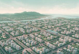
- Nodes and sectors. The city is laid out as townships called nodes. CIDCO’s node plans mark sector boundaries (see the Vashi node plan), and addresses often carry a sector number, as the addresses on NMMC’s ward offices page show.
- Mixed land use. The Vashi node plan shows residential, commercial and service-industry zones, a wholesale market and warehouse area, and open space.
- Navi Mumbai Metro Line 1. CIDCO’s project page describes a corridor from Belapur to Pendhar, and its 2026-27 budget statement reports the line’s ridership.
- The airport. Navi Mumbai International Airport commenced commercial operations on 25 December 2025, per its operator’s release.
Where is Navi Mumbai, and which district is it in?
Navi Mumbai is on the mainland in Maharashtra. It extends through parts of two districts, and the district depends on the place:
- Thane district: the Thane district website lists NMMC among its municipal corporations. NMMC’s history page names Belapur, Nerul, Vashi, Sanpada, Koparkhairane, Ghansoli and Airoli among the nodes CIDCO developed.
- Raigad district: the Raigad district website lists Panvel Municipal Corporation, and PMC’s corporation map names Panvel taluka and Raigad district. PMC’s history page names Taloja, Kharghar, Kalamboli, Kamothe and New Panvel among the CIDCO colonies in its area.
- Ulwe and Dronagiri: a Raigad district notice places the Ulwe node in Panvel taluka and the Dronagiri node in Uran taluka, so both are in Raigad district. Which municipal or service authority covers a particular address is a separate question. Check the property tax bill or ask the local office.
- Uran: Uran town has its own municipal council in Raigad district. NMMC’s history page counts 28 Uran taluka villages among the 95 villages of the project area.
A place can sit in a CIDCO node, inside one body’s limits and in one district, and the three do not always line up neatly. Before you rely on the label “Navi Mumbai” in a listing, identify the authority responsible for that address. The NMMC services guide covers what NMMC handles, and the Panvel, Kharghar and Taloja comparison covers three PMC-area locations.
Examples by place
| Example | Municipal body | District | Note |
|---|---|---|---|
| Vashi | NMMC | Thane | A CIDCO node. NMMC’s ward C office is at Vashi |
| Sanpada | NMMC names it among the nodes CIDCO developed | Thane, following NMMC | For a specific address, check the body named on the property’s tax records |
| Kharghar | PMC | Raigad | PMC lists ward A as Kharghar |
| Ulwe | Check for the address | Raigad (Panvel taluka) | District per the Raigad district notice |
| Dronagiri | Check for the address | Raigad (Uran taluka) | District per the Raigad district notice |
| Uran town | Uran Municipal Council | Raigad | Listed on the Raigad district website |
These are selected examples, not a full directory. The areas guide covers the full set of nodes and how each is governed.
How Navi Mumbai is laid out
CIDCO’s published resources do not all present the node list identically. Its nodal-plan download index contains 13 entries, while a February 2022 CIDCO document names 14 nodes, including Pushpak: Airoli, Ghansoli, Koparkhairane, Vashi, Sanpada, Nerul, CBD Belapur, Kharghar, Kamothe, New Panvel, Kalamboli, Ulwe, Dronagiri and Pushpak. CIDCO’s development plan page also speaks of 14 nodes. A download index should therefore not be treated as an exhaustive statement of current boundaries. The areas guide has the detail.
NAINA stands for Navi Mumbai Airport Influence Notified Area. It is a separately notified planning area for which CIDCO is the Special Planning Authority, rather than another name for the airport site or a Navi Mumbai node. See CIDCO’s NAINA page, its NAINA FAQ and the NAINA guide.
Seawoods and Juinagar are locality names that are also Harbour line station names, per the line listing. A station name is not an administrative boundary. If you are choosing where to live, the best areas in Navi Mumbai guide compares the main nodes.
How Navi Mumbai came about
The idea of a new centre across the water is older than CIDCO. CIDCO’s history page traces proposals through the 1940s and a study group report in February 1959. It says a 1965 article, “Bombay: Planning and Dreaming”, by Shirish Patel, Charles Correa and Pravina Mehta set out a planning outline. A regional planning board then drafted a regional plan in January 1970 that backed new centres across the harbour as an alternative growth pole to ease the crowding of offices in south Mumbai.
CIDCO says it was incorporated on 17 March 1970 and that a State Government resolution the next day gave it the status of New Town Development Authority. That is the date the company was formed, not the date the city was built. Its city boundary page describes a 344 sq km project area covering 95 villages in Thane and Raigad districts and says land acquisition was notified from February 1970. CIDCO’s development plan page says development began at Vashi, after the Thane Creek bridge to Mumbai opened to traffic in 1972.
CIDCO’s formation page lists Shirish Patel (urban development) and Charles Correa (architecture) among the expert advisers appointed by its first managing director. Its account also names committees, a regional planning board and a wider team of advisers, so the city is not the work of one architect.
How Navi Mumbai differs from Mumbai
The two are neighbours but separate in administration. Both are part of the Mumbai Metropolitan Region, which has nine municipal corporations including Greater Mumbai, Navi Mumbai and Panvel, per MMRDA. Mumbai is run by the Municipal Corporation of Greater Mumbai (the BMC). Navi Mumbai is a planned urban area developed by CIDCO, and its municipal administration is split among several bodies.
| Point | Mumbai | Navi Mumbai |
|---|---|---|
| Municipal administration | Municipal Corporation of Greater Mumbai (the BMC) | NMMC and Panvel Municipal Corporation serve major parts. Uran town has its own council. Other places depend on the address |
| Districts | Mumbai City and Mumbai Suburban, per the Mumbai City and Mumbai Suburban district sites | Parts of Thane and Raigad |
| Population (Census 2011) | 124.42 lakh listed for Greater Mumbai | 11.2 lakh listed for NMMC and 5.09 lakh listed for Panvel, per the MMRDA table |
| Housing and commuting cost | Costs vary by neighbourhood, building and travel pattern. Compare the same property type and commute before drawing a cost conclusion | See the cost of living comparison |
These are Census 2011 population figures presented for the areas listed by MMRDA. They are not current population estimates or a combined population total for Navi Mumbai. PMC says on its history page that Panvel Municipal Corporation came into existence on 1 October 2016, which is after Census 2011.
Is Navi Mumbai bigger than Mumbai?
The answer depends on the boundaries being compared. Greater Mumbai’s municipal area, Navi Mumbai’s original CIDCO project area and individual municipal corporations are different geographic units. This guide does not use those figures to claim that one city is larger than the other.
How Navi Mumbai connects to Mumbai and the region
This is a short overview. The dedicated guides cover timetables, fares, tolls and journey planning, and journey times depend on the route and the hour.
- Suburban rail: CIDCO’s railway page lists the Harbour line (Mankhurd to Belapur to Panvel), the Trans-Harbour line (Thane to Turbhe to Nerul and Vashi) and the Belapur and Nerul to Uran line. See the Mumbai local train guide.
- Navi Mumbai Metro Line 1: runs between Belapur and Pendhar, per CIDCO. It is CIDCO’s own project and a separate system from Mumbai’s metro lines. See the metro route and stations guide.
- Roads: CIDCO’s development plan page describes the Thane Creek bridge that joins the northern tip of Mumbai to Vashi. MMRDA’s Atal Setu page describes Atal Setu as improving connectivity between the island city and the mainland (Navi Mumbai) and says it opened for traffic on 13 January 2024. For tolls, see the Atal Setu toll guide.
- Airport: Navi Mumbai International Airport is at Ulwe, per the airport’s transport page. Its operator’s release says it commenced commercial operations on 25 December 2025. See the airport guide and the nearest railway station guide.
Maps and plans, and where to check an address
CIDCO, NMMC and PMC publish different resources for different purposes. Use the group that matches your question.
Maps and plans (official planning or geographic resources):
- CIDCO nodal plans: the Nodal Plan page links a plan for each of its 13 nodes, and the Vashi plan is one example. A note on the Vashi plan says the layout plan is not to be used as a legal document and is subject to change. The page is in Marathi.
- NAINA: CIDCO’s NAINA page links the development plan documents for that separate planning area. The page is in Marathi.
- Panvel Municipal Corporation: the corporation map shows PMC’s boundary, villages, railway and highways. It is not to scale and is in Marathi.
Administrative directories (contacts and offices for checking jurisdiction):
- NMMC: the ward offices page lists the eight ward offices with their addresses.
- PMC: the zone offices page lists wards A to D.
- CIDCO: its contact numbers page lists divisional officers, including one for Ulwe and Dronagiri.
- Districts: the Thane and Raigad district sites list municipal bodies, including Thane and Raigad.
A ward-office directory is not a boundary map. It tells you where an office is, not which addresses it serves, so ask the office or check your property tax bill for the boundary that applies to an address.
Sources
Planning and history: CIDCO’s history, formation, city boundary, development plan and Nodal Plan pages and its February 2022 document. Civic bodies and districts: NMMC’s history and ward offices pages, PMC’s history and zone offices pages, and the Thane and Raigad district sites. Population: the MMRDA Mumbai Metropolitan Region page (Census 2011). Transport: CIDCO’s railway and metro pages, MMRDA’s Atal Setu page, the airport’s transport page and the operator’s release. The other links in the text are to the CIDCO, PMC, district and Wikipedia pages named beside them. Boundaries, services and timetables change, so confirm them with CIDCO, NMMC, PMC or the railway before you rely on them. Last verified: 8 October 2026. NaviMumbai.com is an independent information site and is not affiliated with CIDCO, NMMC, PMC or any government body.
For a visitor’s view of the Nerul, Seawoods and Belapur areas, see our guide to places to visit in Nerul, Seawoods and Belapur.
For the container port at Nhava Sheva, see our JNPT port guide.
Frequently Asked Questions
What is Navi Mumbai?
Navi Mumbai is a planned urban area in Maharashtra, across Thane Creek and Mumbai Harbour from Mumbai. CIDCO, which was incorporated on 17 March 1970, planned and developed it. It forms part of the Mumbai Metropolitan Region and extends through parts of Thane and Raigad districts. It is not a separate district.
Where is Navi Mumbai, and which district is it in?
Navi Mumbai is on the mainland in Maharashtra, across the creek and harbour from Mumbai. It is not a district of its own. It extends through parts of Thane and Raigad districts. The NMMC part, which includes Vashi, Nerul and Belapur, is in Thane district. The Panvel Municipal Corporation part, which includes Kharghar, Kamothe, Kalamboli and Panvel, is in Raigad district. A Raigad district notice places the Ulwe node in Panvel taluka and the Dronagiri node in Uran taluka.
Which municipal corporation runs Navi Mumbai?
No single one does. NMMC and Panvel Municipal Corporation serve major parts of Navi Mumbai. Uran town has its own municipal council, and for places such as Ulwe and Dronagiri you should check which authority covers the address. Municipal administration, district boundaries and CIDCO’s planning responsibilities are different questions, so identify the authority responsible for your property.
What is the difference between Mumbai and Navi Mumbai?
Mumbai is run by the Municipal Corporation of Greater Mumbai (the BMC) and sits in the Mumbai City and Mumbai Suburban districts. Navi Mumbai is a planned urban area developed by CIDCO. It extends through parts of Thane and Raigad districts and is served by NMMC and Panvel Municipal Corporation, among other bodies.
Is Navi Mumbai bigger than Mumbai?
It depends on the boundaries being compared. Greater Mumbai’s municipal area, Navi Mumbai’s original CIDCO project area and individual municipal corporations are different geographic units. This guide does not use those figures to claim that one city is larger than the other.
Is Navi Mumbai cheaper than Mumbai?
Housing and commuting costs vary by neighbourhood, building and travel pattern. Compare the same property type and commute before drawing a cost conclusion. The cost of living comparison on this site sets the two side by side.
Who built Navi Mumbai and when?
CIDCO, a company wholly owned by the Government of Maharashtra, was incorporated on 17 March 1970 to plan and develop it. That is the date the company was formed, not the date the city was built. A regional plan drafted in January 1970 backed new centres across the harbour, and CIDCO says development began at Vashi. Its account names several planners and advisers, including Shirish Patel and Charles Correa.
How many nodes does Navi Mumbai have?
CIDCO’s published resources do not all present the node list identically. Its nodal-plan download index contains 13 entries, while a February 2022 CIDCO document names 14 nodes, including Pushpak. A download index should therefore not be treated as an exhaustive statement of current boundaries.
Is Panvel part of Navi Mumbai?
Panvel appears among CIDCO’s nodes (the nodal-plan index lists Panvel and the February 2022 document lists New Panvel), so it is part of the planned Navi Mumbai. Panvel itself is covered by Panvel Municipal Corporation, not NMMC, and is in Raigad district. PMC says it came into existence on 1 October 2016.